The objetive of the project is to have a system to plan and predict the arrival of emergency vehicles to relief emergencies in the woods.
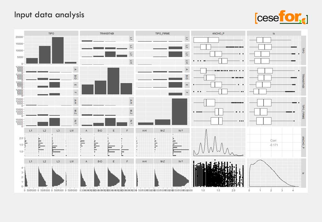
The starting point: Catalog of forest roads of the región of Castilla y León as well as speed data collected by the GPS systems of the vehicles.
Millions of observations collected and 494.623 observations with 0 speed dropped.
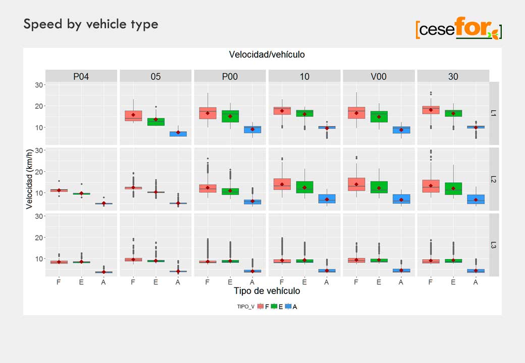
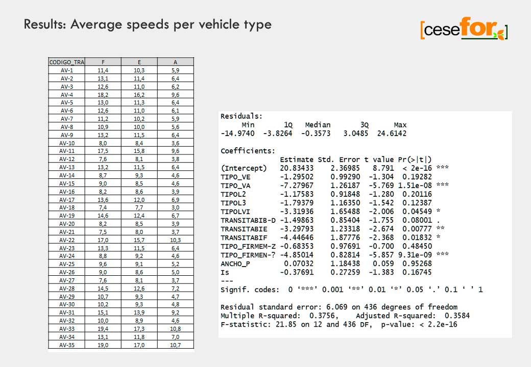
The analysis provided an estimation of the speed on 38.264 forest trails for 3 types of vehicles: F (AWD cars), E (light trucks), and A (fire trucks/trucks)
and the corresponing estimation of time to reach an emergency area.


